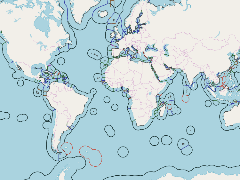
- Thumbnail
- Resource ID
- 809f099c-9d22-11e9-8d7d-000d3ab6a624
- Title
- Maritime boundaries V10
- Date
- July 2, 2019, 6:38 p.m., Publication
- Abstract
- Version 10 of the Maritime Boundaries from the VLIZ Maritime Boundaries Geodatabase. Boundariess have been built using information about treaties between coastal countries. When treaties are not available, median lines have been calculated. This dataset also contains delimitation of disputed boundaries and joint regimes.
- Edition
- --
- Owner
- gridanode
- Point of Contact
- devrsgis@gmail.com
- Purpose
- --
- Maintenance Frequency
- None
- Type
- not filled
- Restrictions
- None
- None
- License
- None
- Language
- eng
- Temporal Extent
- Start
- --
- End
- --
- Supplemental Information
- No information provided
- Data Quality
- --
- Extent
-
- long min: -181.8000030518
- long max: 181.8000183105
- lat min: -77.6190872192
- lat max: 87.8129806519
- Spatial Reference System Identifier
- EPSG:900913
- Keywords
- no keywords
- Category
- None